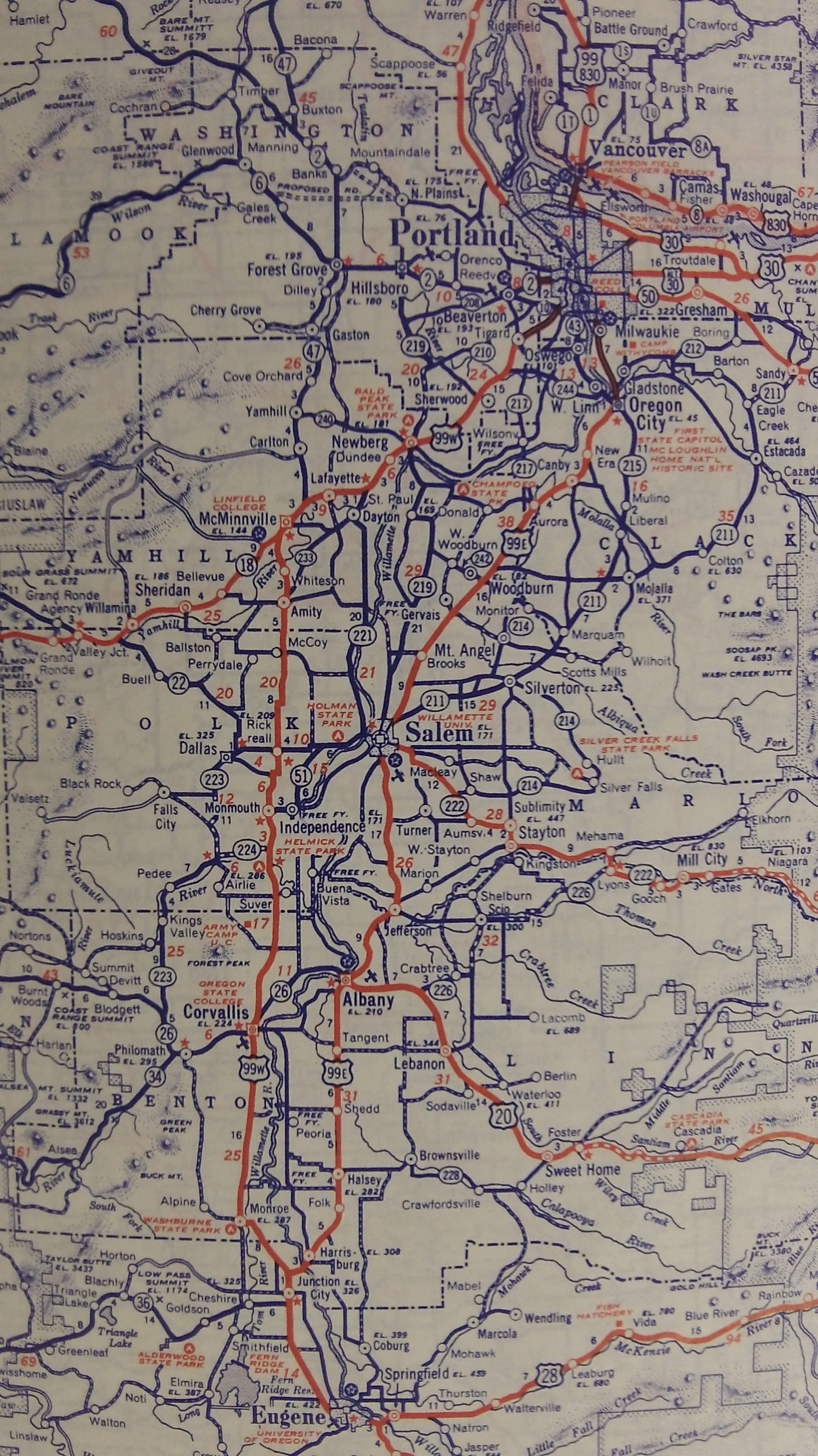
 Before I-5 was a twinkle in the Federal Government’s eye, transportation through the valley looked a little bit different. This map, from the State Farm Road Atlas 1943 War Time Edition, shows the two main arterials through the Willamette Valley — 99E and 99W. This Atlas, cataloged today, was owned by State Farm agent F.F. Anderson in McMinnville. Beside the standard road maps, the special war edition includes information on Air Raids, color maps of the different war theaters, and photos and descriptions of various equipment and machinery used by the U.S. Armed forces.
X2012.023.0001


You may know that the USGS has finally digitized a number of historic maps! Here, for example, are Salem, Salem West, and Salem East quads going back to 1917. (Hopefully the url will persist, but there might be a session id in it.) The maps can be downloaded as pdfs. Other local maps are also available of course!